-

Deutsch
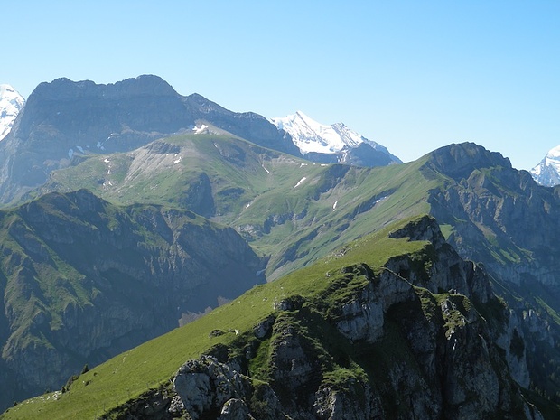
Bachflue - Gipfelkreuz 2180 m
12 Jun 22
Geo-Tags: CH-BE
In der Nähe von: Kiental, Gehrihore / Gehrihorn, Ramslauenen, Ärmighore / Ärmighorn
Fotos (8)
© bergpfad73
Minimap
0Km
Klicke um zu zeichnen. Klicke auf den letzten Punkt um das Zeichnen zu beenden
Tourenberichte (3)
| Frutigland | T3 |
12 Jun 22
|
 Bachflue 2180m
Schöne Tour bei heissem Wetter.
Vorab: Lehrer auf Tourensuche ,bitte nicht mehr weiter lesen. Denn diese Tour ist für Klassenausflüge nicht geeignet.
Start um 8.00 Uhr im Tschingel bei schönstem Wetter. Die Querung vom Ausgangsort rüber bis Alp Gumpel ist recht schwierig. In Bezug auf die gute Wegführung mit möglichst...
Publiziert von
12. Juni 2022 um 21:37
(Fotos:16)
| Frutigland | T3 |
15 Jul 11
|
 - Bachflue (2180/2185m) - und ein Kientaler Dachs") Gehrihorn (2130m) - Bachflue (2180/2185m) - und ein Kientaler Dachs
Gehrihorn (2130m) - Bachflue (2180/2185m) - und ein Kientaler Dachs
Eine feine Voralpentour auf teils nicht sonderlich häufig begangenen Wegen zu zwei hübschen Aussichtsgipfeln. Beide sind als solche problemlos zu ersteigen (T2). Das Gehrihorn kann man auf mehreren Routen erreichen, der Bachflue hatte felix letztlich einen ausführlicheren Part gewidmet - etwas anspruchsvoller ist das...
Publiziert von
3. August 2011 um 15:15
(Fotos:49 | Kommentare:2)
| Frutigland | T4- |
25 Aug 10
|
 erst die Bachflue 2180 m.ü.M. "entdecken", dann via Ärmigchnubel 2412 m.ü.M. zum Giesigrat
Wie nun öfters am Mittwoch müssen wir zeitig zurückgekehrt sein - so soll es keine allzu lange Anfahrt und eine leicht kürzere Tour geben.
Aus ihrem reichen Fundus wählt Ursula für die heutige Rundreise das Kiental aus - und statt "nur" aufs Gehrihore nehmen wir uns auf Anraten von Axi die...
Publiziert von
28. August 2010 um 18:15
(Fotos:52 | Kommentare:5)
Hikr.org hat wenige Berichte für diesen Wegpunkt.
Du kannst jetzt einen Tourenbericht eintragen, oder suchen in der "In der Nähe" Liste.
Du kannst jetzt einen Tourenbericht eintragen, oder suchen in der "In der Nähe" Liste.
Berichte in der Nähe
| Berner Voralpen | L |
7 Mär 24
|
 Chistihubel 2216m
Das lange Warten hat ein Ende: nochmals Neuschnee dieses Jahr bis in mittlere Lagen. Doch ab März hält er jeweils nicht lange. Da heisst es zugreifen, auch wenn ich die heutige Tour zwischen zwei Nachtschichten packen muss. Dementsprechend bleiben die Höhenmeter überschaubar, man ist auch nicht mehr vierzig...
Nach zähem...
Publiziert von
9. März 2024 um 18:32
(Fotos:15 | Geodaten:1)
| Berner Voralpen | WS |
22 Jan 24
|
 Chistihubel - Christ, how cold !
Je me réjouissais de faire découvrir ce coin magnifique à Céline et Vincent avec qui on a tant de bonheur à papoter surtout quand on ne les a plus vus depuis si longtemps. Déjà bien patraque au réveil je refuse l'évidence mais au bout de 2h de montée, grelottant, apathique et nauséeux je suis obligé de capituler...
Publiziert von
23. Januar 2024 um 17:10
(Fotos:6 | Geodaten:1)
| Jungfraugebiet | T3 |
27 Sep 23
|
 Schilthorn, 2970m ab Kiental
Auf dem Schilthorn war ich mutmasslich das letzte Mal in den 70er-Jahren … - Grund genug, diesem Berg wieder mal einen Besuch abzustatten.
Das Frühstück wurde ab 7 Uhr serviert; das war mir jedoch zu spät. Im Wissen, dass die heutige Tour lang werden wird, wollte ich losziehen, sobald es hell wurde – also kurz nach 7...
Publiziert von
25. Oktober 2023 um 08:18
(Fotos:31 | Geodaten:1)


