
"3000m" circuit of the Lac de Moiry
|
||||||||||||||||||||


There is a well-marked hiking route around the Lac the Moury called the "2500m tour", because most of the walk stays around that altitude. Following that example, I'll have to call my route the "Lac de Moury 3000m tour".
----
Day 1
Sorebois - Pointe de Tsirouc - Corne de Sorebois - Arête de Sorebois - Garde de Bordon - Cabane de Moiry
T5 / I, 6h30, 1500m ascent, 1100m descent
From the cable car station at Sorebois, a direct ascent of the Corne de Sorebois leads through a ski area. A more scenic alternative is to loop around the northern side of the mountain, though there's a new huge cable car (Grimenz-Sorebois) on this side as well. After following a panoramic path to Tsirouc, I follow the north ridge onto the Pointe de Tsirouc and further onto the Corne de Sorebois (T4 directly on the ridge, T3 when going around the steeper bits). There are some white-red-white marks leading onto the Pointe de Tsirouc, but it's just as easy to make your own way up. Though dominated by the Corne de Sorebois, the Pointe de Tsirouc actually has the better views onto the Moiry reservoir and dam.
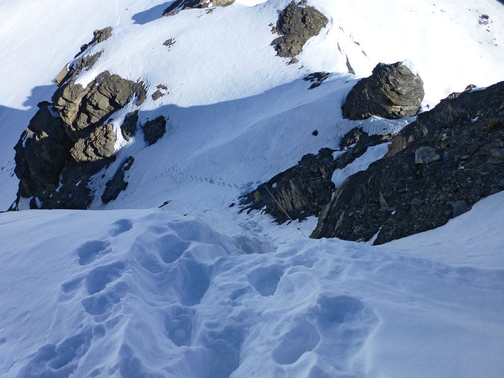
After crossing the ski area, the Arête de Sorebois quickly gets wilder, but without notable difficulties until P. 3046. The escarpment between P. 3046 and P. 3139 is the crux of the route. This involves climbing through a slightly hidden colour (steep and with loose stones, T5) and scrambling up a wall along some fixed ropes (bad quality rock, T5). I make the mistake of actually following the rope, which at first is more bothersome than helpful, and then leads me to climb a bad vertical step, with holds just crumbling away as soon as a I put a foot on them. Very unpleasant. After looking at the reports of Alpenorni and Frangge, I now realise that the rope is rather intended for winter conditions. In summer, it's a considerable better idea to ignore the rope and climb a bit more to the right.
The remaining ridge onto the Garde de Bordon is considerably more gentle. At a respectable 3310m, the summit provides excellent views onto the many still much higher mountains all around. I descend along the SW ridge until about 3150m, then through the scree-filled south face ("Comba Rossa"). The scree here would be unpleasant on the way up, but it's perfect for sinking your feet into while running downhill.
After reaching the marked hiking paths again, there's another 300m ascent to the Cabane de Moiry (T3), which sits in a spectacular spot above the Moiry glacier. It's the final night of the season in the hut. There is an excellent atmosphere and good food on the table. Renovated and extended in 2010, the Cabane de Moiry is an interesting combination of old and new. Unfortunately, the beds are rather too short for me, leading to an uncomfortable night.
Day 2
Cabane de Moiry - Col du Tsaté - Pointe du Tsaté - Pointe du Prélet - Sasseneire - Barrage de Moiry
T4 / I, 8h45, 1500m ascent, 2100m descent
Since the glacier stops me from crossing directly to the west side of the valley, I have to descend all the way to the car park at the Lac de Châteaupré before climbing again to the Col du Tsaté. The first idea here would be to follow the ridge over the Pointe du Bardon, but at least for this section I've done my research properly. I've only read unpleasant things about the Pointe du Bardon (e.g. Sky, johnny68 or Omega3), so I choose to go around it and head straight for the Pointe du Tsaté. This involves descending some 200m on the Val d'Hérens side and traversing pathless above the Lac du Tsaté before joining the normal route onto the SW ridge (unmarked but easy and well-trodden path). At 3078m, the Pointe du Tsaté is only 250m higher than the Cabane de Moiry, but I've already accumulated some 950m of ascent in between!
The ridge over the Pointe du Prélet to the Col de Torrent is a little more challenging. The difficulties don't exceed T4, but sometimes it's not obvious to find the best way around. There's a short, easy ladder between P. 2970 and P. 2972. The final crag just south of the Col de Torrent is by-passed on the Moiry side. You can also rejoin the ridge after the first pinnacle to reach a nice photo spot directly above the col, but a direct descent to the col is not possible.
Just west of the Col de Torrent, the slightly monotonous ascent path onto the Sasseneire begins (unmarked but well-trodden, T3). Unfortunately, this is one of those summits that looks much better from a distance than up close. At an altitude of 3254m, the Sasseneire still offers some great views, of course. Those who really want the complete the 3000m circuit of the Lac de Moiry should also include the final 3000er, Diablon. My legs are getting tired and I've got a bus to catch, so I just descend along the marked hiking paths to the Barrage de Moiry.
----
This area doesn't seem to offer the highest quality alpine hiking routes, due to the amounts of scree and loose stones on almost all mountains around the 3000m mark. The views of the many 4000ers in the immediate vicinity have to make up for that. On a sunny weekend like this, they certainly did so!
----
Day 1
Sorebois - Pointe de Tsirouc - Corne de Sorebois - Arête de Sorebois - Garde de Bordon - Cabane de Moiry
T5 / I, 6h30, 1500m ascent, 1100m descent
From the cable car station at Sorebois, a direct ascent of the Corne de Sorebois leads through a ski area. A more scenic alternative is to loop around the northern side of the mountain, though there's a new huge cable car (Grimenz-Sorebois) on this side as well. After following a panoramic path to Tsirouc, I follow the north ridge onto the Pointe de Tsirouc and further onto the Corne de Sorebois (T4 directly on the ridge, T3 when going around the steeper bits). There are some white-red-white marks leading onto the Pointe de Tsirouc, but it's just as easy to make your own way up. Though dominated by the Corne de Sorebois, the Pointe de Tsirouc actually has the better views onto the Moiry reservoir and dam.
After crossing the ski area, the Arête de Sorebois quickly gets wilder, but without notable difficulties until P. 3046. The escarpment between P. 3046 and P. 3139 is the crux of the route. This involves climbing through a slightly hidden colour (steep and with loose stones, T5) and scrambling up a wall along some fixed ropes (bad quality rock, T5). I make the mistake of actually following the rope, which at first is more bothersome than helpful, and then leads me to climb a bad vertical step, with holds just crumbling away as soon as a I put a foot on them. Very unpleasant. After looking at the reports of Alpenorni and Frangge, I now realise that the rope is rather intended for winter conditions. In summer, it's a considerable better idea to ignore the rope and climb a bit more to the right.
The remaining ridge onto the Garde de Bordon is considerably more gentle. At a respectable 3310m, the summit provides excellent views onto the many still much higher mountains all around. I descend along the SW ridge until about 3150m, then through the scree-filled south face ("Comba Rossa"). The scree here would be unpleasant on the way up, but it's perfect for sinking your feet into while running downhill.
After reaching the marked hiking paths again, there's another 300m ascent to the Cabane de Moiry (T3), which sits in a spectacular spot above the Moiry glacier. It's the final night of the season in the hut. There is an excellent atmosphere and good food on the table. Renovated and extended in 2010, the Cabane de Moiry is an interesting combination of old and new. Unfortunately, the beds are rather too short for me, leading to an uncomfortable night.
Day 2
Cabane de Moiry - Col du Tsaté - Pointe du Tsaté - Pointe du Prélet - Sasseneire - Barrage de Moiry
T4 / I, 8h45, 1500m ascent, 2100m descent
Since the glacier stops me from crossing directly to the west side of the valley, I have to descend all the way to the car park at the Lac de Châteaupré before climbing again to the Col du Tsaté. The first idea here would be to follow the ridge over the Pointe du Bardon, but at least for this section I've done my research properly. I've only read unpleasant things about the Pointe du Bardon (e.g. Sky, johnny68 or Omega3), so I choose to go around it and head straight for the Pointe du Tsaté. This involves descending some 200m on the Val d'Hérens side and traversing pathless above the Lac du Tsaté before joining the normal route onto the SW ridge (unmarked but easy and well-trodden path). At 3078m, the Pointe du Tsaté is only 250m higher than the Cabane de Moiry, but I've already accumulated some 950m of ascent in between!
The ridge over the Pointe du Prélet to the Col de Torrent is a little more challenging. The difficulties don't exceed T4, but sometimes it's not obvious to find the best way around. There's a short, easy ladder between P. 2970 and P. 2972. The final crag just south of the Col de Torrent is by-passed on the Moiry side. You can also rejoin the ridge after the first pinnacle to reach a nice photo spot directly above the col, but a direct descent to the col is not possible.
Just west of the Col de Torrent, the slightly monotonous ascent path onto the Sasseneire begins (unmarked but well-trodden, T3). Unfortunately, this is one of those summits that looks much better from a distance than up close. At an altitude of 3254m, the Sasseneire still offers some great views, of course. Those who really want the complete the 3000m circuit of the Lac de Moiry should also include the final 3000er, Diablon. My legs are getting tired and I've got a bus to catch, so I just descend along the marked hiking paths to the Barrage de Moiry.
----
This area doesn't seem to offer the highest quality alpine hiking routes, due to the amounts of scree and loose stones on almost all mountains around the 3000m mark. The views of the many 4000ers in the immediate vicinity have to make up for that. On a sunny weekend like this, they certainly did so!
Tourengänger:
 Stijn
Stijn
Minimap
0Km
Klicke um zu zeichnen. Klicke auf den letzten Punkt um das Zeichnen zu beenden
Galerie


 Bitte warten...


Kommentare (6)