-

Deutsch
Egghalde 565 m
29 Jan 23
Geo-Tags: CH-AG
In der Nähe von: Geissberg, Cheisacherturm, Albbruck, Bürersteig
Fotos (1)
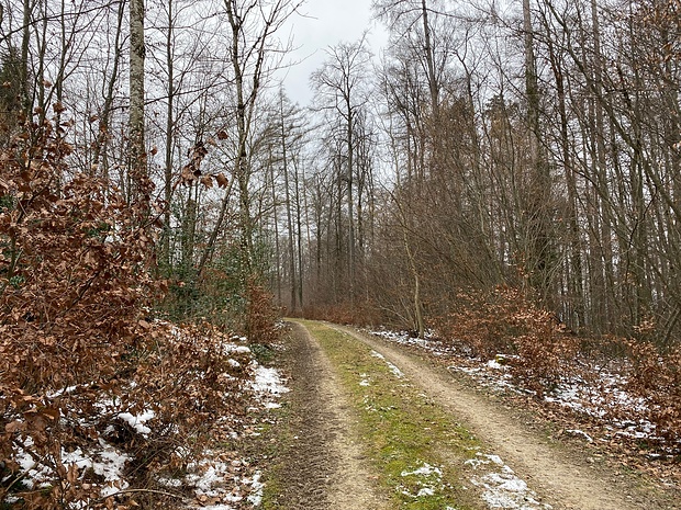
"Gipfel" der Egghalde © Makubu
Minimap
0Km
Klicke um zu zeichnen. Klicke auf den letzten Punkt um das Zeichnen zu beenden
Tourenberichte (1)
| Aargau | T1 |
29 Jan 23
|
 Von Schwaderloch nach Gansingen
Bei der Busstation Schwaderloch, Bahnhof starte ich. Südwärts bei der Kirche vorbei geht's in Richtung Schofhalde und zum Aussichtspunkt Wandfluh.Von hier aus überblickt man die Gegend um Leibstadt. Im Blickfeld natürlich das AKW, aber auch das Rheinkraftwerk. Bei P542m vorbei peile ich nun den Wisstannenkopf an. Den höchsten...
Publiziert von
31. Januar 2023 um 15:25
(Fotos:11 | Geodaten:1)
Hikr.org hat wenige Berichte für diesen Wegpunkt.
Du kannst jetzt einen Tourenbericht eintragen, oder suchen in der "In der Nähe" Liste.
Du kannst jetzt einen Tourenbericht eintragen, oder suchen in der "In der Nähe" Liste.
Berichte in der Nähe
| Aargau | T2 |
26 Feb 24
|
 Geissberg - Bürerhorn
Aufgrund der aktuellen Schneesituation wieder mal eine Wanderung im Jura-Gebirge.
Vom Bürersteig ist die Route hinauf zum Geissberg gelb markiert. Auf dem Weg in Richtung Sparberg müssen zwei Strassen gequert werden. Schmale Pfade führen an "Hinter dem Geissberg" hinauf zum Sendeturm. Der höchste Punkt des...
Publiziert von
2. März 2024 um 12:51
(Fotos:6 | Geodaten:1)
| Aargau | WS |
23 Jul 23
|
 Alpezeiger & Geissberg
In den Bergen meldeten die Meteorologen bis zu 80 km/h Wind. Ein Grund für uns das nördlicher gelegene Flachland aufzusuchen. Auch dort profitierten wir noch vom erfrischenden Wind.
Gestartet sind wir beim Sportplatz Au. Auf direktem Weg erreichten wir mit dem Bike die Aare, wo wir rasch eine Bank fanden, wo wir zuerst eine...
Publiziert von
27. Juli 2023 um 19:44
(Fotos:23 | Geodaten:1)
| Aargau | T1 |
23 Apr 23
|
 Leibstadt - Reuenthal - Koblenz
In Leibstadt angekommen, wende ich meine Schritte zuerst zur Bäckerei Maier. Sie hat Sonntags bis um elf geöffnet. Kaffee mit Gipfeli zum Start tun gut! Sitzplätze hat es zwar keine, zu klein ist der Laden, aber stehend geniesse ich ihn sehr. Jetzt kann‘s losgehen. Ich nehme den Wanderweg, der direkt nach Süden führt....
Publiziert von
1. Mai 2023 um 23:42
(Fotos:19 | Geodaten:1)
| Aargau | T1 |
30 Mär 23
|
") Cheisacher(-Turm)
Cheisacher(-Turm)
Heute wollte ich eine Wanderung unternehmen. Die Wettervorhersage versprach schlechtes und regnerisches Wetter. Erst am Morgen sah ich mir die App von MeteoSchweiz an. Das Wetterradar zeigt nach meiner Erfahrung immer eine sehr gute Regenvorhersage an. Für meine Wahl zur Wanderung zum Cheisacherturm wurde zwischen 12 und 13:30...
Publiziert von
3. April 2023 um 10:48
(Fotos:4 | Geodaten:1)
| Aargau | T2 |
20 Jan 23
|
 Burghalde
Da ich aus gegebenen Anlass nur kleinere Wanderungen unternehme, folgt hier die Ergänzung zur Wanderung auf den Bützberg.
Gestartet bin ich an einem kleinen Parkplatz am Bürersteig. Meine Route wollte ich als Rundtour abwandern. Auf der wenig befahrenen Strasse, die nach Mönthal führt (Bürersteigstrasse), entlang bis...
Publiziert von
24. Januar 2023 um 17:10
(Fotos:7 | Geodaten:1)


