

Eine neue Entwicklung in der Welt der hikr Karte: das Path Tool!
Nun ist es möglich, Wege auf der Karte zu zeichnen, Entfernungen und Höhen zu messen, sie in KML-Format zu speichern, sie zu einem Bericht zu fügen und die KML-Datei für GoogleEarth zu exportieren.
Das Tool ist noch nicht voll entwickelt, wir planen noch ein paar coole Features, aber man kann ihn bereits testen. Ihr findet das Tool unter der Adresse www.hikr.org/new_map.php und klickt auf den "Path-Editor" Link in der Tool-Liste. Einige Erklärungen dazu sind ebenfalls verfügbar bei klicken auf den Link "Hilfe". Viele Texte sind im Moment nur in englischer Sprache, jede mögliche Hilfe um sie zu korrigieren und übersetzen in Deutsch ist willkommen.
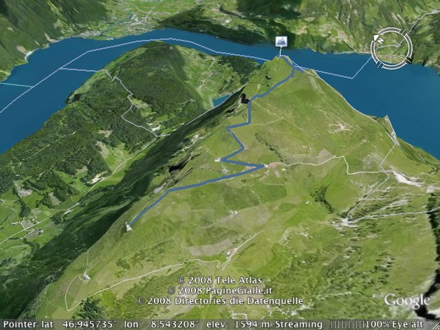
Ein weiteres Feature ist, dass man jetzt xol und gpx geofile auf der Website in KML-Format für GoogleEarth exportieren kann. Auf der Bericht-Seite mit einer Geo-Datei beigefügt (zum Beispiel www.hikr.org/tour/post4777.html) findet ihr einen Link "Export KML". Wenn ihr darauf klickt, könnt ihr die Geo-Datei in GoogleEarth exportieren und viel Spass haben bei schauen an den schönen Schweizer Bergen in 3D hohe Auflösung wie in diesem Screenshot.
Some new development in hikr map world: the path tool!
Now it is possible to draw paths on the map, measure distances and elevations, save them in KML format, attach them to a hike and export the KML file for GoogleEarth.
The tool is not yet fully developed, we plan to still add some cool feature, but you can already test it. You find the tool at the address www.hikr.org/new_map.php and clicking on the “path editor” in the tool list. Some explications about how to use the tool are also available clicking on the link “help”. A lot of texts are for the moment only in English, any help for correct them and translate them into German are welcome.
Another feature is that now you can export any xol and gpx geofile present on the site in KML format for GoogleEarth. On the page of a hike with a geofile attached (for example www.hikr.org/tour/post4777.html) you find a link “Export KML”. If you click on it, you can export the geofile in GoogleEarth and enjoy looking at beautiful Swiss mountains in 3D high resolution like in the screenshot.


Kommentare (6)