Day 9: Summit Day on Mount Whitney
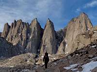
This was summit day for Mount Whitney which got me very excited, but at the same time I realized that it was December 10th which was my brother Kevin's birthday. I was sad that I could not visit him, especially the fact that he was in the hospital and last I heard he was in critical condition. I would go many moments during the trip remembering this fact, almost as if haunting me hoping that he was alright. As we get out of the tent the sun light starts arriving on the lower part of Owen's Valley now drizzled in contrasting light. We start out hiking in the lower basin of Iceburg Lake, like all the days I was amazed to see so much nice weather. In Washington you would pretty much never get this much good weather in December.

Approaching Iceberg Lake |
|
Approaching Mount Whitney |
|

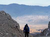
Looking at the Alabama Hills |
|

Iceberg Lake |
|
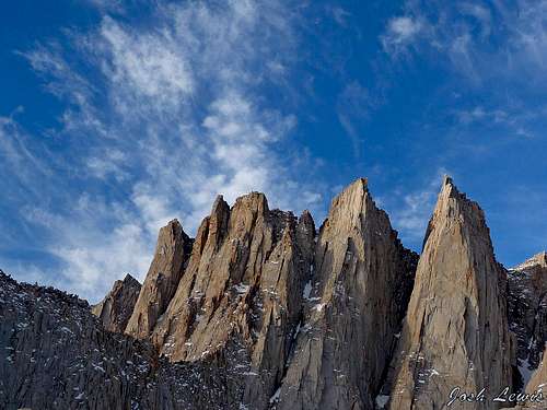
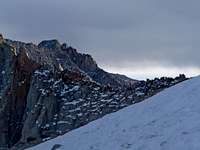
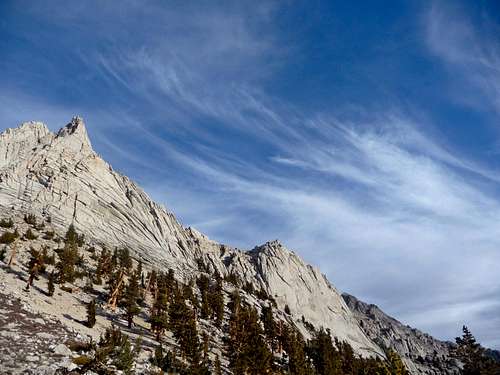
Clouds over Mount Whitney |
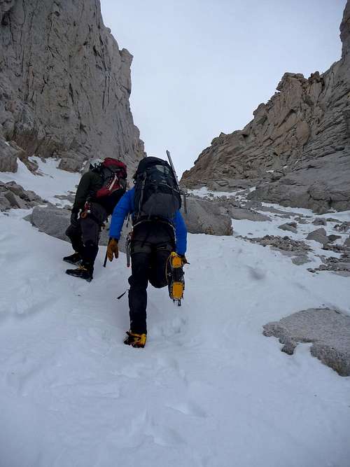
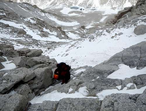
Looking up the Mountaineers Route |
Pretty soon we arrive near Iceburg lake excited to look up the Mountaineers Route of Mount Whitney. A few hundred feet later we decide to put on our crampons and pull out our ice axes for the gully. The snow conditions were superb, every step was nice and solid but at the same time not icy either. It took us about an hour to get to the top of the gully which we took our time going up. After topping out we start traversing into the north side of Mount Whitney. Very soon we realize that there is a bit of an icy section that has a bit of exposure. Looking up the North Face we see repel slings and decide that it would be a better route. We didn't know a lot about the face, but figured we were close to the summit and would at least give it a shot.

Above The Coulior |
|

Climbing Steps up the Face |
|
Peaks to the North |
|

High In The Coulior |
|
Hiking up the Mountaineers Gully |
|

Climbing up the North Face |
|

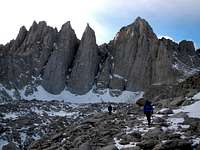
Hiking up the Mountaineers Coulior |
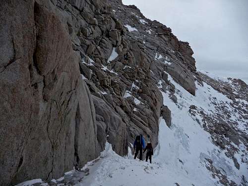
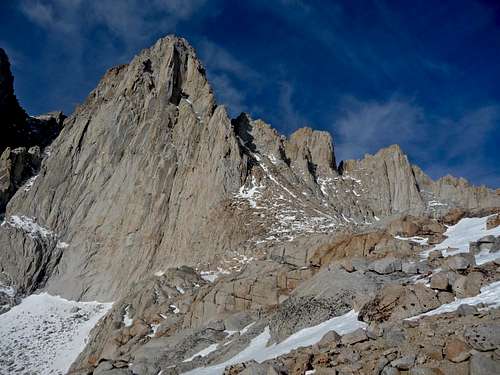
Approaching the North Face |
For the most part it was very solid class 3 scrambling that was exciting to climb up. Michael started heading over to the right more while I followed Gimpilator towards the left. I took a bit of a different variation than Gimpilator and some how found myself on a class 5 move. I can be pretty sure it was class 5 because I had to use good technique of using my crampons on the rock and doing a bit of a move. It did make me feel a bit uncomfortable, but I knew that I would not have to down climb that spot. Gimpilator scored pretty well and found a few slings and climbing nuts which of course he didn't take them all. After a bit more scrambling we reached flatter terrain where it was a super easy walk up to the summit. Michael and I kept our crampons on to prevent the hassle of putting them on later.
Final Scramble Section |
|

Looking down on Carillon |
|
Looking towards Mount Russel |
|
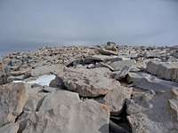
The Relatively Flat Summit |
|
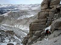
Myself Climbing up the North Face |
We were all very pleased to make it to the summit of Mount Whitney in December, especially with wonderful weather and doing it via the North Face. We had heard that week earlier winds were blowing well over 100 miles an hour. The summit register papers were scattered and shredded, the summit house door was completely broken. After snapping a few more pictures we decided that it was time to start heading down.
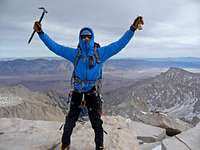
Sauce Boss on the Summit |
|
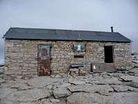
Mount Whitney's Summit House |
|
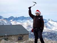
Gimpilator Excited |
|

Heading back Down |
|

Josh, Adam, and Michael Happy to be on the Summit |

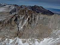
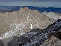
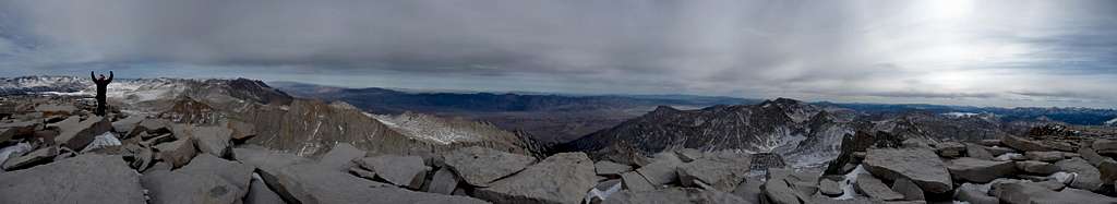
Views to the North Panorama |
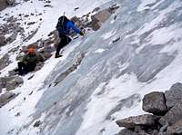
We went down the normal mountaineers route to make the descent easier. For the most part it was a walk down with a pinch of scrambling in a few spots. Pretty soon we came across the ice step section that had made us not want to go up the rest of the mountaineers route. When searching for an easier alternative there was none. Michael and I took our time to cross it, the main reason I felt a little nervous was the fact that my crampon spikes were short (they were the only pair that worked with this boot) making for a not so great purchase on the ice. I certainly did not bring them on Mount Hood. Anyways I managed to get though by taking careful steps.

The Mountaineers Route |
|

Crossing the Ice Step |
|
Setting up the Belay |
|

Looking Down the Ice Step |
|

Gimpilator Approaching the Ice Step |
Gimpilator did not like the look of it so he requested a belay across. Michael brought out the ice screws for an anchor and set them in the ice. He also made a great rope throw to Gimpilator which then he tied into and I was the belayer. After a few minutes I belayed Gimpilator across the ice section, we were now able to proceed with the descent. In the gully itself I was able to speedily plunge step, I was tempted to glissade the rest of the way down but figured I better not with all the mini rocks everywhere. As I looked up I could see a rainbow above Mount Whitney with cirrus clouds.
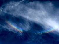
Rainbow in the Clouds |
|

Lone Pine Peak |
|

Exiting the Mountaineers Route |
|

Iceburg Lake Frozen Over |
|
Last Light on the Mountain |
|
Michael with Nice Scenery |
|

Heading on Out |
|
Iceberg Lake Basin |
|

Heading Down the Mountaineers Route |
|

Myself Heading Down |
|
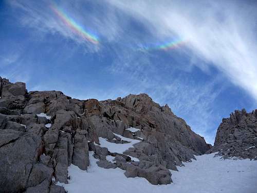
Rainbow Above Mount Whitney |

Evening Light on the Mountains |
Going back to camp was an easy walk. The sun was starting to set which meant that it would be wise to make good time for the rest of the way down. But the fact was that we had to pack the tent away, eat and drink for the way down which took time. I tried warming up the water filter and going to the lake to filter water, but the tube had already froze again. So I had to run to camp and stuff it in my puffy jacket to thaw it out.
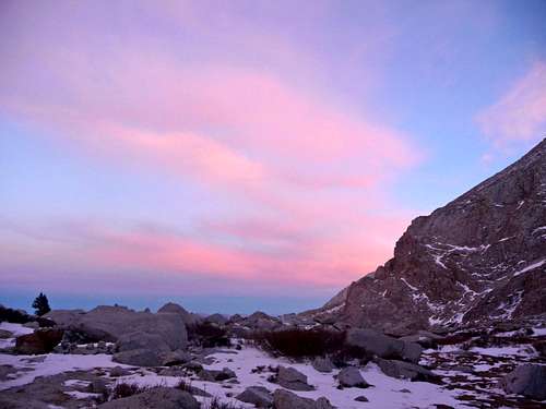
Sunset from our Camp |
By now we were all almost completely packed, but I knew that I had to filter water for the way down. Michael seemed very tired and he too was out of water. "Josh, you have 5 minutes!" Michael yelled back to me as I was running back towards the lake. The filter was once again not working which I furiously started pumping for about a minute until I finally got it to work. I started working on my first bottle and heard "3 minutes!"... after what felt like a few seconds I heard "2 minutes!" which I was in a bit of a panic because there is no way that I would compromise our hydration. The filtering process was very slow going and required me to go slow to make the pumping work faster. By the time I got to the next bottle I hear Michael yell "Times up! We gotta go!". I yell back "Ok, leave me!". There are two aspects to what I said, either a. he would not actually leave me b. even if they both left without me, what I was doing was more important. After all with Michael as tired as he was without water, he would not be getting too far without me.

Pink Sky Above the Mountain |
Out of breath I screw on the lid and dash back to camp feeling tired from all the running around and stress. Sometimes you have to stick up for the team, even when one of your team members doesn't realize it at the time. Finally we started heading down the mountain which I led us down a ways. There were many ice slabs which I saw one that was pretty scary. It looked almost like a frozen river which appeared to go all the way down to the cliffs below which worried me a bit. Gimpilator sees this and decides that it would be best for us to go down the way we scrambled up a few days earlier. We had to hike up hill a little bit. Michael finally announces "Guys, we gotta stay another night. I can't go on doing this for hours more". I glance over at Gimpilator and tell him that we have to stay another night. We set down our packs and did some searching around for a place to bivy, Gimpilator happened to find a flat spot which seemed almost impossible on this section of the mountain. We carried up our packs and set them down next to our camping spot. Non of us felt like dealing with the hassle of using a tent so we brought out our sleeping bags and pads to rest for the night. Gimpilator helped make water while I was the snow fetcher trying to get the freshest snow as possible. Even with that in mind, there were quite a few interesting things including pine needles in our water. "Pine Needle Tea" Gimpilator joked. After drinking some warm water it was time to get some rest for the next day.
Day 10: Death Valley and Manly Beacon
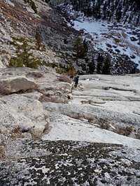
During the night the clouds and winds picked up a little making me wonder if a storm was coming in. In the morning I was pleased to still see that the weather was decent. After packing up our gear we had a few minutes walk until we came across the scramble section. This time we decided to go down the slabs instead. It looked a bit dangerous at first, but as long as you slowly walked along, everything was just fine. There was at least one tedious spot where you should be on all fours climbing down. In about 20 minutes we were down at the bottom.

Our Shortcut Route |
|
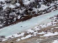
One of the many Ice Slabs |
|

Looking Back towards Whitney |
|

Blue Jay |
|

View from our Bivy |
|

Another Minute Please |
|
Looking Down Below |
|
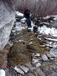
Hiking over a small Creek |
|
Cirrus Clouds above Carillon |
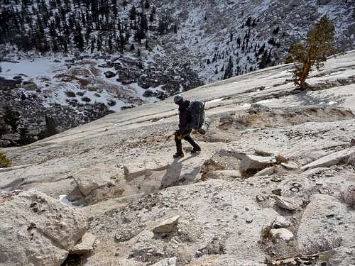
Hiking down the Slabs |
From Lower Boyscout lake it took almost 2 hours to hike back down to Whitney Portal. We had the usual scrambling and walking over a few icy spots on the trail. On the way down we met up with a guy who climbed the Mountaineers Route in a single day, he offered to drive Michael down to the Lone Pine Camp Ground from the Whitney Portal which was mighty decent of him to do that. It was out of his way because it would be a while before his buddies got back down to the trailhead which he was there driver (I think, considering that he drove back up). At the trailhead it felt so nice to relax and take off my boots which I consider the single best thing that one does when they finish a climb.
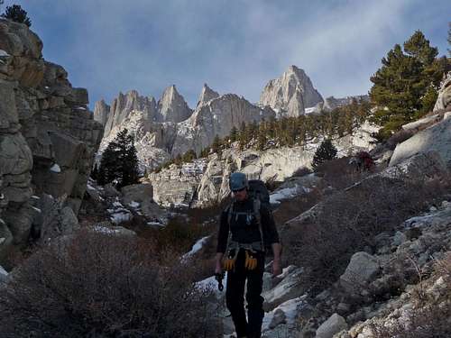
Michael with Mount Whitney in the Background |

Scrambling Down |
Continue the story with Part 4


 Josh Lewis


Kommentare