FAQ
Einloggen
Anmeldung
Home
Journal
Regionen
Fotos
Geo
Map
Comm
Leute
Deutsch
▶
◀
Col de Chargerat
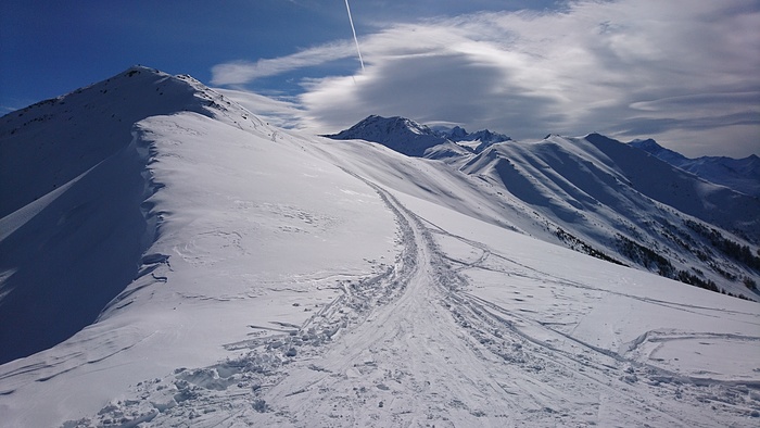
Mont Brûlé (2571) vom Skigebiet Bruson
Kommentare
Kommentar hinzufügen
Kommentar hinzufügen»
Um einen Kommentar zu hinterlassen, musst du
eingeloggt sein
.
Ort Fotos
Nach Publikationsdatum
« Zurück
Vor »
3
auf 7 Fotos
Mont Brûlé (2571) vom Skigebiet Bruson
Tête de la Payanne
Schweiz
»
Wallis
»
Oberwallis
zu Favoriten hinzufügen
Auf dem Bild
Mont Rogneux (3084m.)
Gipfel in 17 Tourenberichte, 55 Foto(s).
Geo-Tags:
CH-VS
Mont Rogneux 3084m.
Tête de la Payanne (2452m.)
Gipfel in 5 Tourenberichte, 7 Foto(s).
Geo-Tags:
CH-VS
Tête de la Payanne 2452m.
Mont Brûlé (2572m.)
Gipfel in 7 Tourenberichte, 9 Foto(s).
Geo-Tags:
CH-VS
Mont Brûlé 2572m.
Schlagwörter
Communities
©
cardamine
, Hochgeladen am 29. März 2020 um 19:40.
Fotografiert am 8. März 2020 um 10:44 mit einer
F5121 (Sony)
Reduzierte Grösse
Siehe in Originalgrösse
Diese Seite wurde
350
mal angezeigt
Benutzer Homepage
Journal
Gipfel
Fotos
Favoriten
Freunde
Sende mir eine Nachricht
Info
Bitte warten...


Kommentare