
▶
⨯
◀
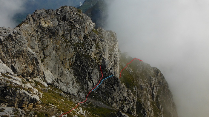
This photo taken from the summit depicts my route through the south flank and south east side. During the descent I followed the blue line, which shortened the climbing section a little bit. (The climbing section itself is not visible here).
|

Kommentar hinzufügen»


Kommentare (1)