FAQ
Einloggen
Anmeldung
Home
Journal
Regionen
Fotos
Geo
Map
Comm
Leute
Deutsch
▶
◀
Lumbrein & Co.
Um Su: da Lumbrein (Mulin) a Obersaxen (Tobel)
Kommentare
Kommentar hinzufügen
Kommentar hinzufügen»
Um einen Kommentar zu hinterlassen, musst du
eingeloggt sein
.
Ort Fotos
Nach Publikationsdatum
« Zurück
Vor »
4
auf 12 Fotos
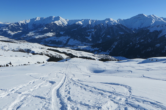
Um Su: da Lumbrein (Mulin) a Obersaxen (Tobel)
Calasagrat
Schweiz
»
Graubünden
»
Surselva
zu Favoriten hinzufügen
Auf dem Bild
Lumbrein (1405m.)
Ort in 40 Tourenberichte, 16 Foto(s).
Geo-Tags:
CH-GR
Lumbrein 1405m.
Piz Fess / Chli Fess (2875m.)
Gipfel in 18 Tourenberichte, 109 Foto(s).
Geo-Tags:
Signina
,
CH-GR
Piz Fess / Chli Fess 2875m.
Piz Signina (2848m.)
Gipfel in 4 Tourenberichte, 62 Foto(s).
Geo-Tags:
CH-GR
Piz Signina 2848m.
Piz Riein - Nordgipfel (2752m.)
Gipfel in 10 Tourenberichte, 59 Foto(s).
Geo-Tags:
Signina
,
CH-GR
Piz Riein - Nordgipfel 2752m.
Güner Horn / Piz Gün (2851m.)
Gipfel in 8 Tourenberichte, 76 Foto(s).
Geo-Tags:
Signina
,
CH-GR
Güner Horn / Piz Gün 2851m.
Crap Grisch / Planggenhorn (2861m.)
Gipfel in 8 Tourenberichte, 88 Foto(s).
Geo-Tags:
CH-GR
Crap Grisch / Planggenhorn 2861m.
Calasagrat (2440m.)
Gipfel in 1 Tourenbericht, 12 Foto(s).
Geo-Tags:
CH-GR
Calasagrat 2440m.
Schlagwörter
Dorf
Spur
Tal
Communities
©
neutrino
Pro
, Hochgeladen am 21. Januar 2018 um 23:39.
Fotografiert am 14. Januar 2018 um 11:51 mit einer
Canon PowerShot SX280 HS (Canon)
Reduzierte Grösse
Siehe in Originalgrösse
Diese Seite wurde
63
mal angezeigt
Benutzer Homepage
Journal
Gipfel
Fotos
Favoriten
Freunde
Sende mir eine Nachricht
Info
Bitte warten...


Kommentare