-

Deutsch
Birchhöchi 894 m
Geo-Tags: CH-BL
In der Nähe von: Belchenflue / Bölcheflue, Waldenburg, Gwidemhöchi, Langenbruck
Fotos (1)
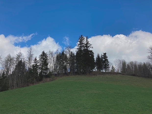
Blick vom Sattel Birchhöchi zur Erhebung Birchhöchi © Felix
Minimap
0Km
Klicke um zu zeichnen. Klicke auf den letzten Punkt um das Zeichnen zu beenden
Hikr.org hat noch keinen Tourenbericht für diesen Wegpunkt.
Du kannst jetzt einen Tourenbericht eintragen, oder suchen in der "In der Nähe" Liste.
Du kannst jetzt einen Tourenbericht eintragen, oder suchen in der "In der Nähe" Liste.
Berichte in der Nähe
| Basel Land | T5 |
13 Feb 24
|
 kurz & knackig: Zustieg Gerstel durch das Südcouloir
Beim Durchblättern des SAC-Kletterführers "Basler Jura" auf diesen Zustieg gestossen.
NB: Im Gerstel gilt ab Januar bis Juni das amtliche Kletterverbot in den Sektoren der Grossen Südwand und Stilli Wand. Obwohl seit Jahren keine Brutaktivität dort stattfindet. In allen anderen Sektoren vom Spitzenflühli bis zum...
Publiziert von
13. Februar 2024 um 21:00
(Fotos:23 | Kommentare:4)
| Basel Land | T5 |
30 Jan 24
|
 kurz & knackig: Schwängiflüeli Westgrat
Dies dürfte wohl meine letzte Vertigo-Pendenz in der Nordwestschweiz gewesen sein und auch die happigste.
Rundtour von/nach Langenbruck.
Auf dem WW bis Hof Schwengi. Dann auf dem Forstweg zu Pt. 859. Hier auf schmalem Pfad auf den Grat. Den Pfeiler bei Pt 944 umgehe ich rechts, um dann auf einer Rampe links auf den Grat zu...
Publiziert von
31. Januar 2024 um 09:40
(Fotos:22 | Kommentare:7)
| Basel Land | T6- III |
3 Dez 23
|
Vorweg: zum Zeitpunkt meiner Begehung hatte es viel Schnee im Jura, der Grat war von mindestens 30 cm bedeckt. Ich kann deshalb nur für die Begehung bei Schnee sprechen, ohne stelle ich mir die Überschreitung auch anders vor!
Der Westgrat des Schwängiflüeli bietet einige Kraxelpassagen auf sehr dünnen, links und...
Publiziert von
5. Dezember 2023 um 08:54
(Kommentare:13)
| Basel Land | T3+ I |
2 Nov 23
|
 Fleissiges Güpfesammeln im Land der kleinen Berge in herrlicher Herbst-Stimmung
Mein Schwager fragte mich am vorhergegangenen Weekend an, ob ich spontan Zeit hätte an einem Mittwochmorgen. Wettervorhersage war sehr gut, ein Trockenfenster zwischen einem verregneten Dienstag und einem verregneten Donnerstag. Voraussage hat sich als richtig herausgestellt. Weil unser Zeitfenster effektiv begrenzt war durch...
Publiziert von
3. November 2023 um 12:33
(Fotos:20 | Kommentare:2)
Publiziert von
24. Oktober 2023 um 21:36
(Fotos:3)
| Basel Land | T2 |
15 Okt 23
|
 Einsame Tour über Solothurner und Baselbieter Höhenzüge zur Hinteren Egg und weiter nach Waldenburg
Von meinem Wohnort Frenkendorf auf die Hintere Egg. Das habe ich bereits zwei Mal gemacht. Das erste Mal war in meinen Vor-Hiking-Zeiten. Nachdem ich gewissermassen ca 35 Jahre lang gemeint hatte, dass der höchste Punkt des Baselbiets die Wasserfallen-Bergstation sei, las ich eher durch Zufall über die Hintere Egg und nahm mir...
Publiziert von
17. Oktober 2023 um 16:16
(Fotos:12 | Kommentare:4)


