

▶
◀
UPDATE 11/12/2016: on a subsequent exploration, I have discovered further paths and the Alpinahütte. Rather than updating this map, I will refer to the more accurate and more complete map by Uto869.
-----
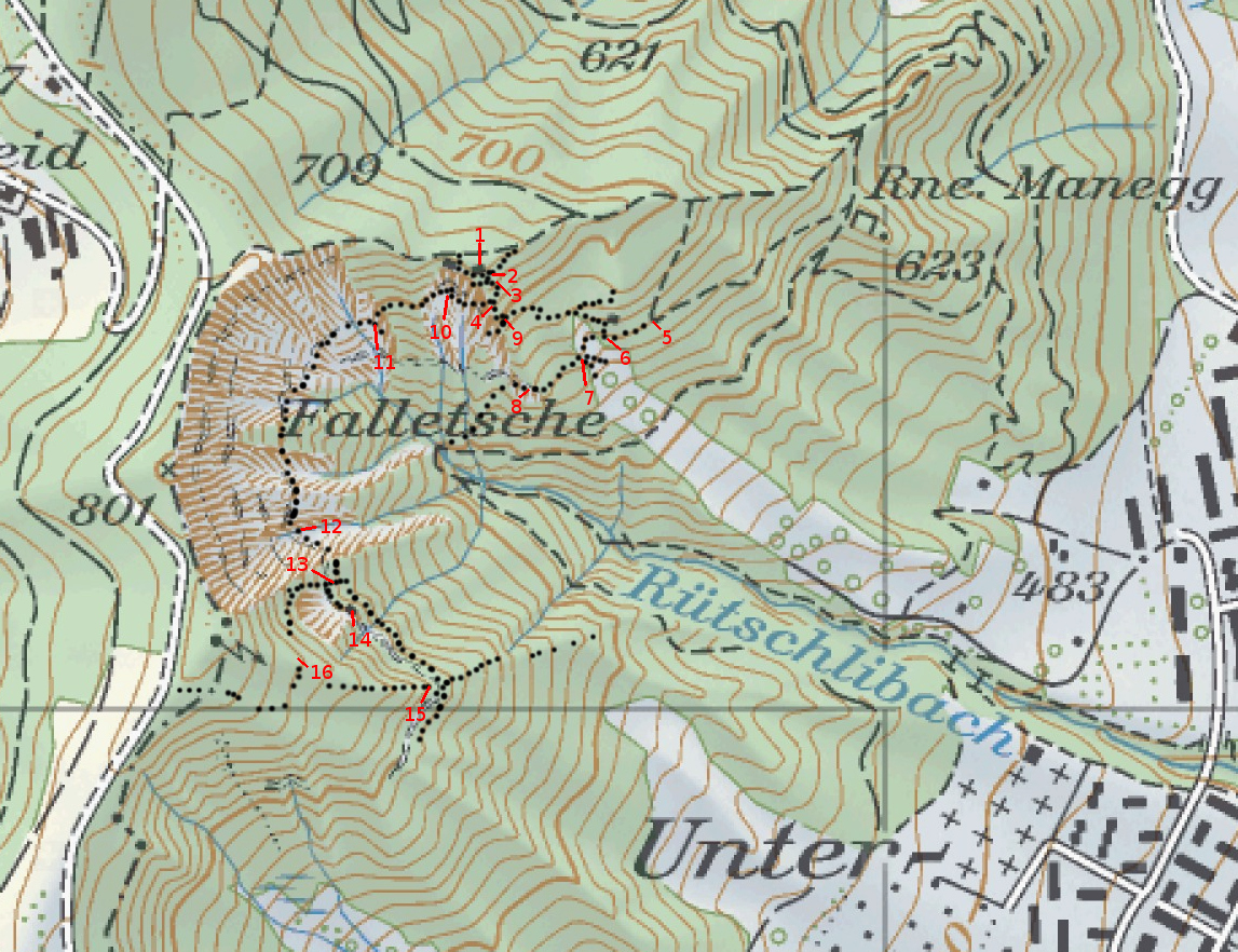
The dotted back lines are mine - they represent paths that are not marked on the SwissTopo maps. The lines are not very accurate and incomplete, but hopefully still useful.
The numbers also appear in the description of the photos that follow.
1 - Teehütte
2 - Junction below the Teehütte
3 - Caution - misleading junction
4 - Best start of the Fallätsche Traverse
5 - Junction when approaching from Ruine Manegg
6 - Junction at the Bristen-Stäffeli Hütte.
7 - Wood storage.
8 - Alpen-Club Felsenkammer hut
9 - Caution - misleading junction
10 - Crossing the landslide below the Teehütte
11 - Small fork in the Fallätsche traverse
12 - Key section of the traverse, protected with a rope
13 - Ladder
14 - Glecksteinhütte
15 - Short grade I scramble
16 - Paths covered by foliage, though a few blue-white markings can be found
-----
The dotted back lines are mine - they represent paths that are not marked on the SwissTopo maps. The lines are not very accurate and incomplete, but hopefully still useful.
The numbers also appear in the description of the photos that follow.
1 - Teehütte
2 - Junction below the Teehütte
3 - Caution - misleading junction
4 - Best start of the Fallätsche Traverse
5 - Junction when approaching from Ruine Manegg
6 - Junction at the Bristen-Stäffeli Hütte.
7 - Wood storage.
8 - Alpen-Club Felsenkammer hut
9 - Caution - misleading junction
10 - Crossing the landslide below the Teehütte
11 - Small fork in the Fallätsche traverse
12 - Key section of the traverse, protected with a rope
13 - Ladder
14 - Glecksteinhütte
15 - Short grade I scramble
16 - Paths covered by foliage, though a few blue-white markings can be found
Kommentar hinzufügen»
. Open on Sundays and holidays.")
Züge fahren hier übers Meer")


Kommentare