-

Deutsch
Le Mourin 2766 m
3 Sep 23
Geo-Tags: CH-VS
In der Nähe von: Bourg-St-Pierre, Bourg-Saint-Bernard, Cordonna, Les Monts Telliers
Fotos (2)
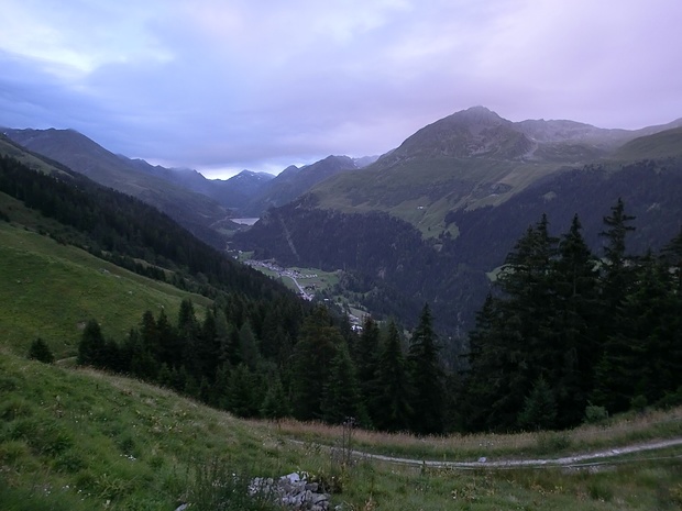
© Sky
Minimap
0Km
Klicke um zu zeichnen. Klicke auf den letzten Punkt um das Zeichnen zu beenden
Tourenberichte (4)
| Unterwallis | T4 |
3 Sep 23
|
 Le Mourin 2766m
Vielleicht eher T4+, aber nur weil ich irrtümlich zu früh in den grasigen Steilhang eingebogen bin. Nimmt man die Normalroute würde ich eher von T3+ reden, abgesehen vom kurzen T4-Stück bei der teilweisen exponierten Umgehung des letzten Gratkopfs.
Start also beim Parkplatz bei Pkt 1822m oberhalb des Staudammes. Bis zur...
Publiziert von
3. September 2023 um 19:36
(Fotos:11 | Kommentare:2)
| Unterwallis | T3 |
28 Sep 11
|
 Grande dalle de Becca Colinte, une curiosité
Depuis ma première randonnée dans le Val d'Entremont, un sommet formé d'une grand dalle m'intriguait: Becca Colinte.
Je ne voulais pas terminer ma série d'ascensions dans la vallée sans aller voir de plus près cette curiosité.
C'est au début de l'automne 2011 que j'ai eu l'occasion d'y aller. Étant seul et...
Publiziert von
13. August 2013 um 17:28
(Fotos:50)
| Unterwallis | T3 |
7 Okt 10
|
 Merveilleuse journée d'automne autour du Mourin
C'est par une très belle journée d'octobre que j'ai entrepris la randonnée qui m'avait fait envie lorsque j'avais vu les lieux depuis mon ascension du Beaufort.
Cette randonnée s'est révélée être encore plus merveilleuse que ce que j'avais osé espérer. Cela a été très difficile pour moi de choisir les photos...
Publiziert von
13. August 2013 um 14:45
(Fotos:62 | Kommentare:1)
| Unterwallis | T4- |
30 Jun 07
|
 Le Mourin depuis la Letta
Par peur de l'excès de trafic j'avais évité le Val d'Entremont pour mes randonnées en montagne. Cependant depuis 2007 j'y ai trouvé un grand nombre d'ascensions intéressantes sans de trop grandes difficultés techniques. La première fut le Mourin, le 30 juin 2007.
Ne sachant combien de temps il me faudrait pour m'y...
Publiziert von
4. August 2013 um 16:29
(Fotos:9)


